Golan Heights
 |
| Golan Heights |
The Golan Heights is a strategic plateau and mountainous region at the southern end of the Anti-Lebanon Mountains. The geographic area lies within, or borders, the countries of Israel, Syria, Lebanon and Jordan. The Golan plateau encompasses about 1,800 square kilometres (690 sq mi); it is situated south of the mountains and extends to the east. Since 1967, the term generally refers to a somewhat different 1,200 square kilometres (460 sq mi) area that includes the western portion of the plateau, a small portion of the Jordan River Valley in the northwest, and higher, mountainous areas in the north, which descend to the southeast from Mount Hermon. The Golan Heights are of great strategic importance in the region. The Golan Heights were undisputed Syrian territory until Israel captured the region on 9-10 June 1967 during the Six-Day War. The area has remained under Israeli occupation since then. The territory was successfully defended by Israel in the 1973 Yom Kippur War, though a portion was later returned to Syria. In 1981 the area was unilaterally annexed by Israel, a move condemned internationally. The Golan Heights remain disputed, with an ongoing Syrian claim for the land to be returned.
The name "Golan" refers to both Biblical and historical names for the southern portion of the area. In contemporary usage, the “Golan Heights” refers to the territory captured by Israel from Syria.
Syria maintains that the Golan Heights are within the Quneitra Governorate. Israeli sources and the U.S. Committee for Refugees reported that the local population fled, whereas the Syrian government indicated that a large proportion of it was expelled. Starting in the 1970s, new Jewish settlements were established in the captured area. Israel asserts its right to retain the area under the text of United Nations Security Council Resolution 242, which calls for "safe and recognized boundaries free from threats or acts of force". In 1981, Israel formally applied its "laws, jurisdiction and administration" to the Golan Heights with the passage of the Golan Heights Law. It has been governed since as part of Israel’s North District. This annexation is not internationally recognized and United Nations Security Council Resolution 242 considers the area part of the Israeli occupied territories.
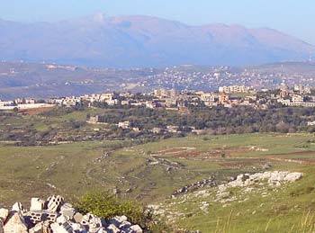
Geography
Topographically, the Golan Heights ranges in elevation from 2,814 m (9,230 feet) on Mount Hermon in the north, to about sea level on the Yarmuk River in the south. The steeper, more rugged topography is generally limited to the northern and western portions, and approximately bounded by the Sa’ar valley to the south. The extreme northwestern area includes the mountainous Shebaa Farms area, which is disputed between Lebanon and Syria, as well as flat land in the Jordan valley, which extends west to the Hasbani River and the town of Ghajar, on the former Syrian – Lebanese border. This area includes the only overland route, between Syria and Lebanon, south of the Golan Heights.
The broader Golan plateau exhibits a more subdued topography, generally ranging between 400 and 1,700 feet (120–520 m) in elevation. To the east and at lower elevation, the plateau merges into the Hauran plain of Syria; the limits are not clearly defined, although Wadi Ruqqad and Nahr Allan are sometimes considered geographically. In Israel, the Golan plateau is usually divided into three regions: northern (between the Sa'ar and Jilabun valleys), central (between the Jilabun and Daliyot valleys), and southern (between the Dlayot and Yarmouk valleys). The Golan Heights is bordered on the west by a rock escarpment that drops 1,700 feet (500 m) to the Jordan River valley and the Sea of Galilee. In the south, the incised Yarmouk River valley marks the limits of the plateau and, east of the abandoned railroad bridge upstream of Hamat Gader and Al Hammah, it marks the recognized international border between Syria and Jordan.
Geologically, the Golan plateau and the Hauran plain to the east constitute a Holocene volcanic field that also extends northeast almost to Damascus. Much of the area is scattered with dormant volcanos, as well as cinder cones, such as Majdal Shams. The plateau also contains a crater lake, called Birkat Ram ("Ram Pool"), which is fed by both surface runoff and underground springs. These volcanic areas are characterized by basalt bedrock and dark soils derived from its weathering. The basalt flows overlie older, distinctly lighter-colored limestones and marls, exposed along the Yarmouk River in the south.
The rock forming the mountainous area in the northern Golan Heights, descending from Mount Hermon, are geologically quite different from the volcanic rocks of the plateau, including a different physiography. The mountains are characterized by distinctly lighter-colored, Jurassic age limestone of sedimentary origin. Locally, the limestone is broken by faults and solution channels to form a karst-like topography in which springs are common (e.g. Baniyas. The Sa'ar valley generally divides the lighter-colored sedimentary rocks of the mountains from the dark-colored volcanic rocks of the Golan plateau. The western border of both the Golan plateau and the mountains is truncated structurally by the Jordan Rift Valley, along which the Jordan River and its northern tributaries flow.
In addition to its strategic importance militarily, noted above, the Golan Heights provides significantly to the water resources of the region. This is true particularly for higher elevations, which are snow-covered much of the year in the cold months and help to sustain baseflow for rivers and springs during the dry season. The heights receive significantly more precipitation than the surrounding, lower-elevation areas. The occupied sector of the Golan Heights provides or controls a substantial portion of the water in the Jordan River watershed, which in turn provides a portion of Israel's water supply. The Golan Heights are the source of about 15% of Israel's water supply.
Geography
In addition to the importance of water resources, the Golan Heights also has Israel's only ski resort, near Mount Hermon. Winemaking is a major and highly successful industry. Cattle graze on the upland plateau. The area is also popular for bush walking.
In 2005 the Golan Heights had a population of approximately 38,900, including approximately 19,300 Druze, 16,500 Jews, and 2,100 Muslims.
Current Status
The Golan Heights were under military administration between 1967 and 1981. In that year, Israel passed the Golan Heights Law, placing the Golan Heights under civilian Israeli law, administration, and jurisdiction. Most non-Jewish residents of the Golan Heights, mainly Druze, refused to surrender Syrian citizenship, though Israeli citizenship was available to them.
In the 1999 elections, 773 residents of Ghajar and fewer than 700 residents of the 4 Druze villages were eligible voters. Syria continues to offer them benefits such as free university tuition.
In 2005 the Golan Heights had a population of approximately 38,900, including approximately 19,300 Druze, 16,500 Jews, and 2,100 Muslims. Jewish villages, including moshavim and kibbutzim, are consolidated municipally under the Golan Regional Council, and are inhabited by Israeli citizens. The Golan Muslims reside in the Israel-Lebanon border-straddling village of Ghajar. They accepted Israeli citizenship in 1981. The Druze reside in the villages of Ein Qinya, Buq'ata, Majdal Shams, and Mas'ada. Most are involved in farm work.
Both personal and business relations exist between the Druze and their Jewish neighbors; there is little tension between the two groups. As a humanitarian gesture, since 2005, Israel allows Druze farmers to export some 11,000 tons of apples to Syria each year, the first kind of trade ever made between Syria and Israel. Since 1988, Israel has allowed Druze clerics to make annual religious pilgrimages to Syria.
The Druze
Unlike Druze in Israel proper, fewer than 10% of the Druze of the Golan Heights are Israeli citizens; the remainder hold Syrian citizenship. The latter are permanent residents of Israel, and they hold a laissez-passer. The pro-Israeli Druze are ostracized by the pro-Syrian Druze. Reluctance to accept citizenship also reflects fear of ill treatment or displacement by Syrian authorities should the Golan Heights eventually be returned to Syria. According to The Independent, most Druze in the Golan Heights live relatively comfortable lives in a freer society than they would have in Syria under the present regime. According to Egypt's Daily Star, their standard of living vastly surpasses that of their counterparts on the Syrian side of the border. Hence their fear of a return to Syria, though most of them identify themselves as Syrian. Ties to Syria are on the wane, and many have come to appreciate aspects of Israel's liberal-democratic society, although few risk saying so publicly for fear of Syrian retribution.[